logo dark logo
  • Dog Friendly Lists
  • Find a Hike
  • Discount Codes
  • Fav Gear
  • About
    • Testimonials
    • Awards & Features
Mobile Logo
  • Dog Friendly Lists
  • Find a Hike
  • Discount Codes
  • Fav Gear
  • About
    • Testimonials
    • Awards & Features
Top
Home  >  Hiking   >  Hiking the Parrish Canyon Trail, Centerville, Utah
Central Utah

Hiking the Parrish Canyon Trail, Centerville, Utah

Hiking
Share the love!
Shares

 Parrish Canyon Trail, Parrish Creek Trail, Hiking in Utah with Dogs

The Parrish Canyon Trail starts along the Wasatch Mountains in Centerville, Utah. Despite its name, the hike actually takes you up the face of the mountain, over a course of several switchbacks, gaining elevation steeply until you have beautiful views of Davis County. This is a nice hike to do in Winter to get out of the inversion and to get the dogs out. If you hike up the actual creek, about 1/2 mile up you will see the Parrish Creek Pictographs. In Winter they are not usually visible due to snow.

Contents hide
1 Share the love!
2 About
3 Trail Info
4 Trail Map
4.1 Share the love!

About

 From SLC, drive north on I-15 and take the Parrish Lane exit 319, and continue East towards the mountain. At the very end you will come to a “T” with a sign for the Parrish Reservoir – turn left and drive up the road to the large parking area. My car couldn’t make it up in winter, so we parked by the Reservoir sign.

Trail Info

Distance: 4 miles RT to the Ridge

Elevation Gain: 1,700 ft

Time: 2-4 hours

Dog friendly? Yes, off leash

Kid friendly? Yes, but it is fairly steep

Parrish Canyon Trail, Parrish Creek Trail, Hiking in Utah with Dogs

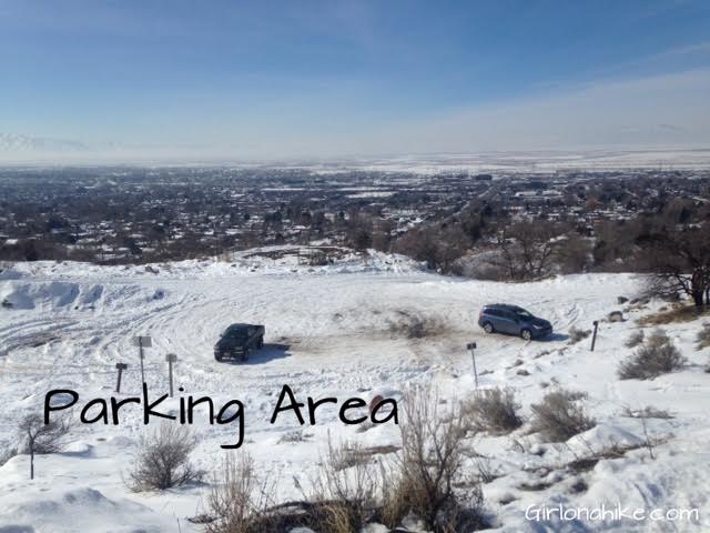
This is the large parking area.

Parrish Canyon Trail, Parrish Creek Trail, Hiking in Utah with Dogs

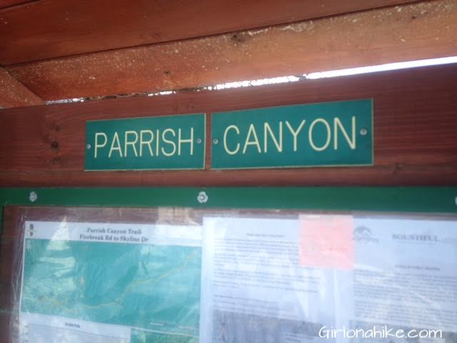
Official Parrish Canyon sign.

Parrish Canyon Trail, Parrish Creek Trail, Hiking in Utah with Dogs

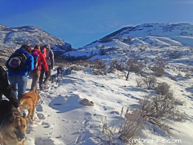
The trail starts right by the official sign and is well defined – once you get to the BST (Bonneville Shoreline Trail), cross it, and continue East.

Parrish Canyon Trail, Parrish Creek Trail, Hiking in Utah with Dogs

Make your way up several switch backs.

Parrish Canyon Trail, Parrish Creek Trail, Hiking in Utah with Dogs

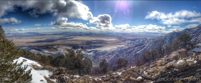
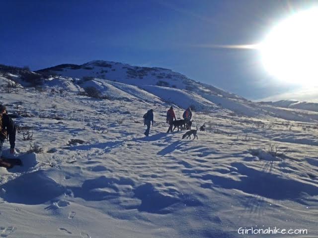
As you get higher, the view of Centerville will get better. You can even see Frary Peak on Antelope Island in the distance, to the left.

Parrish Canyon Trail, Parrish Creek Trail, Hiking in Utah with Dogs

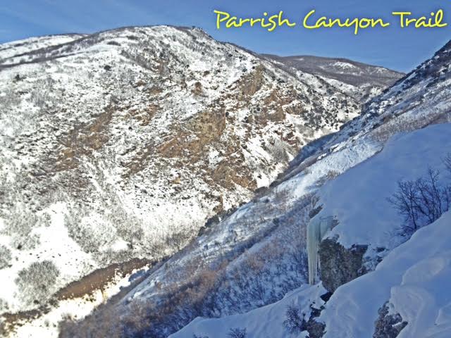
Looking into the canyon, with a cool icicle on the right.

Parrish Canyon Trail, Parrish Creek Trail, Hiking in Utah with Dogs

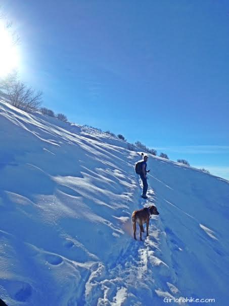
Some of the switchbacks were really steep, and a little scary since they are on the ledge of the face of the mountain.

Parrish Canyon Trail, Parrish Creek Trail, Hiking in Utah with Dogs

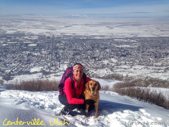
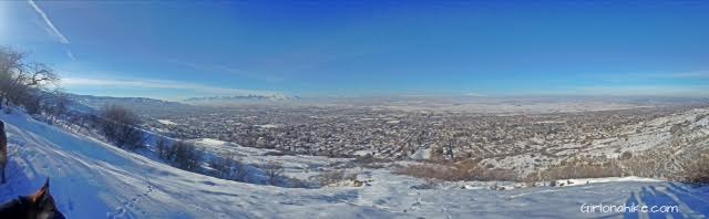
Overlooking Centerville, UT

Parrish Canyon Trail, Parrish Creek Trail, Hiking in Utah with Dogs

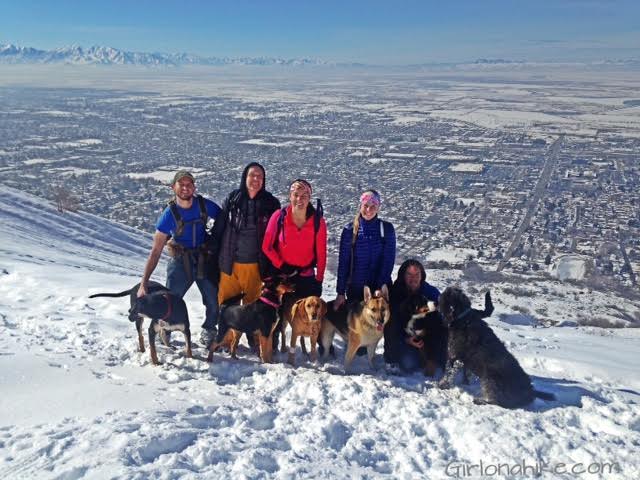
Group photo from our hike.

Parrish Canyon Trail, Parrish Creek Trail, Hiking in Utah with Dogs

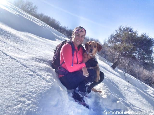
After about 2 miles of hiking, the snow was getting knee deep and we post-holed much of the way. Even the dogs were having a bit of a hard time. We decided to stop while we were in the sun, so we could take a snack break before heading down.

I would say the best time of year to do this hike is in Summer or Fall. Spring would be very muddy, and Winter is just not popular enough to have the trail packed up to the ridge.

Trail Map

Parrish Canyon Trail map, Parrish Creek Trail map

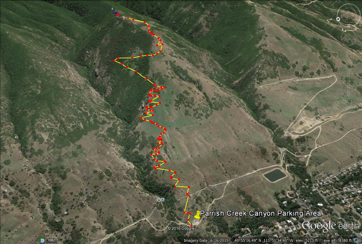
This was where we intended on going, but we only made it 3/4 of the way. Once you make it to the ridge you can stop at any of the rocky overlooks and take a break. If you are feeling really strong, you can hike all the way to the main ridge line.

Parrish Canyon Trail map, Parrish Creek Trail map

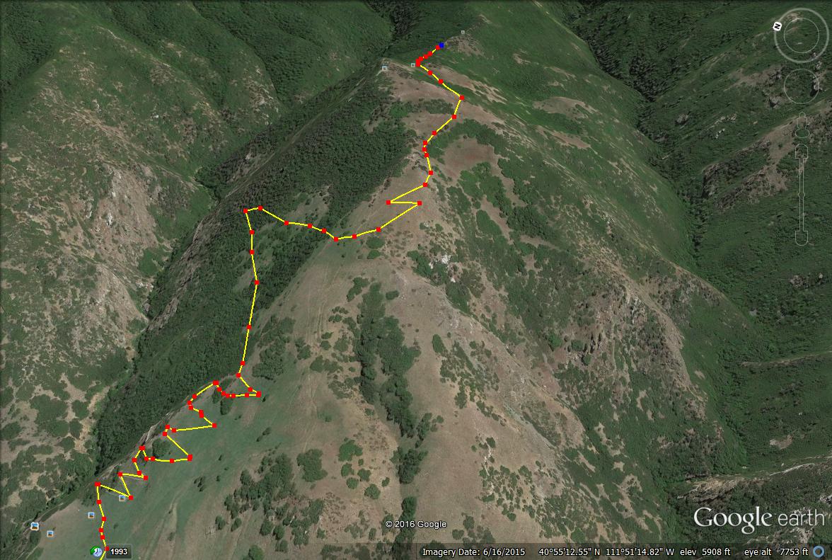
Another view of the route.

Share the love!
Shares
Central Utah Winter Adventures
0
February 9, 2016
previous post
next post

Related Posts

Hiking Neff's Canyon

Hiking Neff’s Canyon

May 6, 2025
Girl On A Hike

Hiking to the Deuel Creek Waterfall

May 4, 2025
Girl On A Hike

Hiking to Desolation Overlook, Millcreek Canyon

April 28, 2025
Girl On A Hike
Search Trail Guides
About Us
Let’s Connect!
Social Icons
Trending Posts
  • Hiking
    Hiking the Indian Trail in Ogden

  • Hike to the Bear Canyon Suspension Bridge, Draper, UT
    Hiking
    Hike to the Bear Canyon Suspension Bridge, Draper, UT

  • Hiking
    Hiking the Three Falls Trail – Alpine, Utah

  • Hike to Paul Bunyan's Woodpile, Utah
    Hiking
    Hike to Paul Bunyan’s Woodpile, Utah

error: Content is protected

Share

Blogger
Bluesky
Delicious
Digg
Email
Facebook
Facebook messenger
Flipboard
Google
Hacker News
Line
LinkedIn
Mastodon
Mix
Odnoklassniki
PDF
Pinterest
Pocket
Print
Reddit
Renren
Short link
SMS
Skype
Telegram
Tumblr
Twitter
VKontakte
wechat
Weibo
WhatsApp
X
Xing
Yahoo! Mail

Copy short link

Copy link
Skip to content
Open toolbar Accessibility Tools

Accessibility Tools

  • Increase TextIncrease Text
  • Decrease TextDecrease Text
  • GrayscaleGrayscale
  • High ContrastHigh Contrast
  • Negative ContrastNegative Contrast
  • Light BackgroundLight Background
  • Links UnderlineLinks Underline
  • Readable FontReadable Font
  • Reset Reset