logo dark logo
  • Dog Friendly Lists
  • Find a Hike
  • Discount Codes
  • Fav Gear
  • About
    • Testimonials
    • Awards & Features
Mobile Logo
  • Dog Friendly Lists
  • Find a Hike
  • Discount Codes
  • Fav Gear
  • About
    • Testimonials
    • Awards & Features
Top
Home  >  Hiking   >  Hiking to Little Black Mountain
Central Utah

Hiking to Little Black Mountain

Hiking
Share the love!
Shares

Hiking to Little Black Mountain, Utah, Hiking in Utah with Dogs

Little Black Mountain sits above the Avenues neighborhood in SLC, and although it seems close, it’s looks are deceiving. This trail offers great views of the SLC valley and the BST (Bonneville Shoreline Trails), but get ready to give your hips and calves a work out. Most of the trail is along the BST ridgeline, but gains 900 ft in 1/2 mile!

Contents hide
1 Share the love!
2 About
3 Trail Info
4 Trail Map
5 Nearby Hike
6 Save me on Pinterest!
6.1 Share the love!


About

 In SLC, head north on 7th Ave. Take a slight left, then right and continue on I St. in the Avenues. Turn right on 13th Ave, then veer left onto Northcrest Drive. Turn left on Terrace Hills drive, and park at the very end of this street, in the cul-de-sac. Here’s a driving map from SLC.


Trail Info

Distance: 10 miles round trip

Elevation gain: 2,600 ft

Time: 3-5 hours

Dog friendly? Yes. There is a sign that says dogs must be leashed, but nobody does.

Kid friendly? No, due to distance

Little Black Mountain trailhead

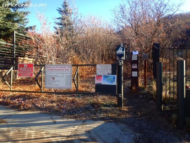
Here is the Trail head area. It starts off to the East side in the cul-de-sac. There is another trail on the West side, but that will lead you the wrong way.

Hiking to Little Black Mountain, Utah, Hiking in Utah with Dogs

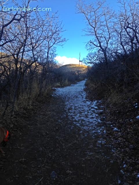
 Starting out, this first section of the trail is shaded, and in winter will usually have snow.

Little Black Mountain, Avenues Twin Peaks

 At the first 4 way intersection, keep going straight. You will see the Avenue’s Twin Peaks ahead, which is a great, short hike, and can be hiked year-round.

Hiking to Little Black Mountain, Utah, Hiking in Utah with Dogs

 The trail will turn North. You will want to take the trail that heads for this small saddle.

Hiking to Little Black Mountain, Utah, Hiking in Utah with Dogs

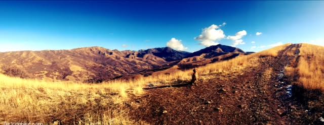
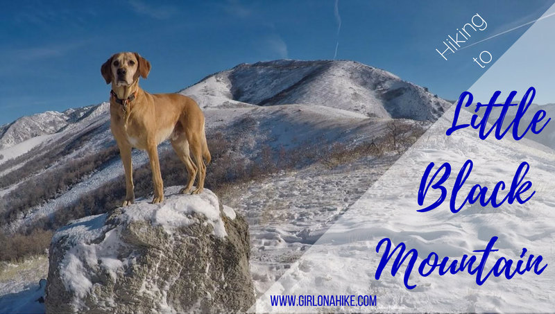
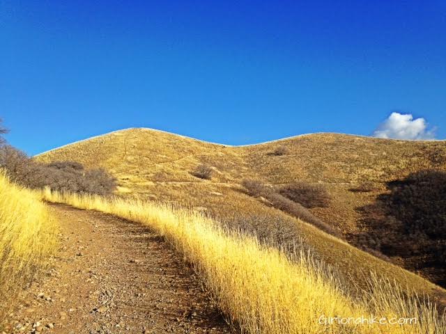
 On the ridge! For the next 1.5 miles or so, the trail follows the rolling hills and ridgeline. Little Black Mountain is the peak to the right, by the clouds.

Hiking to Little Black Mountain, Utah, Hiking in Utah with Dogs

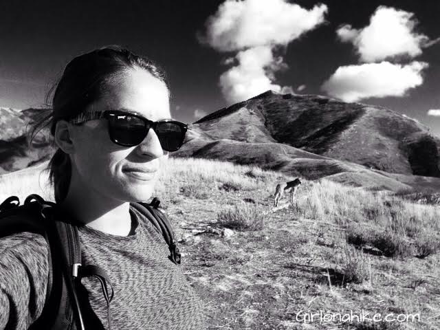
 Selfie time with Charlie!

Hiking to Little Black Mountain, Utah, Hiking in Utah with Dogs

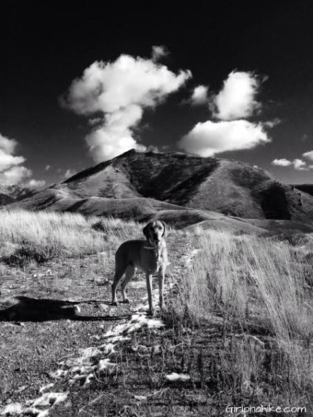
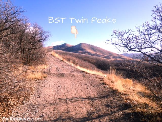
At 1.6 miles, you will see the trail turn off for the BST Twin Peaks. I recommend to stop and take in the view from here, then continue along the ridge. This was our view from the trail turning off to Twin Peaks, with Little Black Mountain above Charlie.

Hiking to Little Black Mountain, Utah, Hiking in Utah with Dogs

Making our way up higher!

Hiking to Little Black Mountain

 This is where I consider the “base” of Little Black Mountain to be. From here, the trail gets very steep, gaining 900 ft in just 1/2 mile. Take your time. Poles may help, and depending on snow level, you may need to put microspikes on. Surprisingly, this is where you start to see trees, after hiking the whole ridgeline in direct sun.

Hiking to Little Black Mountain, Utah, Hiking in Utah with Dogs

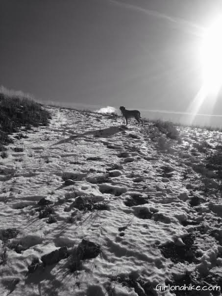
 Charlie making his way up the steep, snowy section.

Little Black Mountain, Salt Lake City inversion, SLC smog

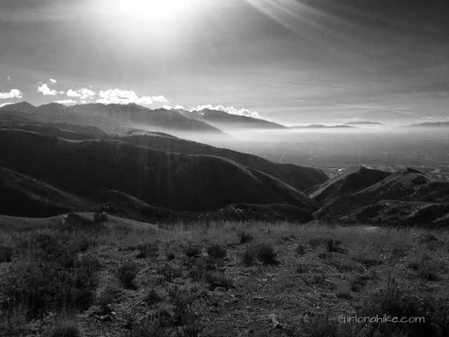
 I decided I was ready to turn around from this point, and drank hot tea before heading down. Again, here is what the inversion looks like in winter. I think I was able to hike out and above it, but you can never be sure. I was just glad I got to enjoy the sunny day with Charlie.

Hiking to Little Black Mountain, Utah, Hiking in Utah with Dogs

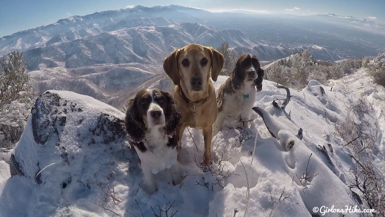
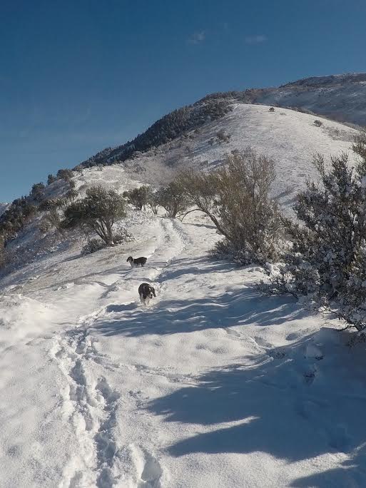
 Same trail, more snow! November 2017

Hiking to Little Black Mountain, Utah, Hiking in Utah with Dogs

 Winter hike with my baby.

Hiking to Little Black Mountain, Utah, Hiking in Utah with Dogs

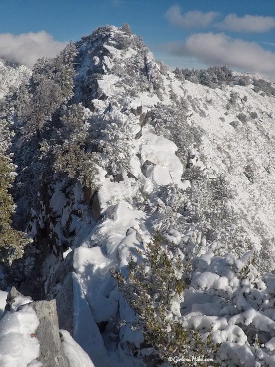
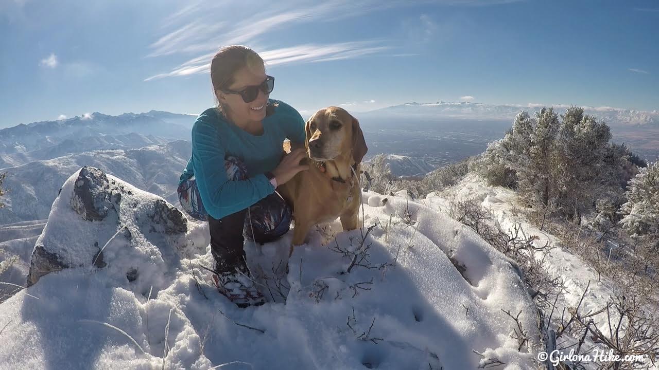
I didn’t quite make it to the summit this trip because the snow got a little sketchy along this narrow ridge. I still had roughly 3/4 mile to go to reach the summit.


Trail Map

My track via Gaia GPS – the best tracking app! Get your app here for a discount.

Nearby Hike

Mt. Van Cott

Hiking to Mt.VanCott

Save me on Pinterest!

Hiking to Little Black Mountain, Utah, Hiking in Utah with Dogs

Share the love!
Shares
Peak Bagging
0
December 7, 2015
previous post
next post

Related Posts

Hiking Mt. Timpanogos via Aspen Grove

August 4, 2024
Girl On A Hike

Hiking to Mt. Superior & Monte Cristo Peak

July 4, 2024
Girl On A Hike

Hiking to Grandeur Peak, Millcreek Canyon

June 26, 2024
Girl On A Hike
Search Trail Guides
About Us
Let’s Connect!
Social Icons
Trending Posts
  • Hiking
    Hiking the Indian Trail in Ogden

  • Hike to the Bear Canyon Suspension Bridge, Draper, UT
    Hiking
    Hike to the Bear Canyon Suspension Bridge, Draper, UT

  • Hiking
    Hiking Mt. Olympus

  • Hiking
    Hiking the Three Falls Trail – Alpine, Utah

error: Content is protected

Share

Blogger
Bluesky
Delicious
Digg
Email
Facebook
Facebook messenger
Flipboard
Google
Hacker News
Line
LinkedIn
Mastodon
Mix
Odnoklassniki
PDF
Pinterest
Pocket
Print
Reddit
Renren
Short link
SMS
Skype
Telegram
Tumblr
Twitter
VKontakte
wechat
Weibo
WhatsApp
X
Xing
Yahoo! Mail

Copy short link

Copy link
Skip to content
Open toolbar Accessibility Tools

Accessibility Tools

  • Increase TextIncrease Text
  • Decrease TextDecrease Text
  • GrayscaleGrayscale
  • High ContrastHigh Contrast
  • Negative ContrastNegative Contrast
  • Light BackgroundLight Background
  • Links UnderlineLinks Underline
  • Readable FontReadable Font
  • Reset Reset