Hiking the Broad Canyon Loop to Goat, Betty, and Baptie Lakes in Idaho’s Pioneer Mountains is an unforgettable alpine adventure. This 12-mile loop trail winds past five sparkling alpine lakes, follows a crystal-clear creek, and opens up to sweeping high-alpine mountain views. Along the way, you’ll pass through lush vegetation and colorful seasonal wildflowers, making this one of the most scenic and rewarding hikes in Idaho.
About
Perfect for hikers seeking both challenge and scenery, this loop showcases some of the most stunning landscapes the Pioneer Mountains have to offer. Whether you’re an experienced backpacker or a dedicated day hiker/runner, this trail promises unforgettable alpine beauty at every turn.
My Experience on the Broad Canyon Loop
After hearing about the Standhope Ultra Race held each July in the area, I knew I had to check it out for myself. I didn’t want to wait until next year, and with my school semester finished, it was the perfect time for a road trip. I’m so glad I tackled the Goat, Betty & Baptie Lakes loop in a single day.
I decided to tackle the loop clockwise—ascending via the Broad Canyon Trail and descending along the Jarvis Trail. I chose this route thinking the Broad Canyon side was steeper, since I prefer to hike up steep terrain and run down more gradual slopes. After completing the loop and reviewing the trail stats, I realized it was actually the opposite.
Trail Section Comparison: Broad Canyon Trail vs. Jarvis Trail
Broad Canyon Trail
-
Pros: More gradual ascent, easier to hike uphill.
-
Cons: Rockier terrain, which can slow your pace.
Jarvis Trail
-
Pros: Fewer rocks, making it easier to run downhill.
-
Cons: Steeper and more exposed, with limited water sources.
On a Monday, I only saw one other backpacker the entire time! The skies were a brilliant blue, the temperatures were perfect, and the trail offered an amazing adventure. I highly recommend this loop to anyone looking for scenic alpine hiking in Idaho’s Pioneer Mountains.
Directions
Important Warning:
Do NOT take the road over Corral Creek Summit Pass unless you have an ATV or lifted 4×4 vehicle. This route is a narrow, rocky, one-lane dirt road not suitable for standard cars. I attempted it once and quickly turned around— even in a Tacoma—realizing it would take much longer than expected. Here is a driving map for the correct route with written directions below.
From Mackay, Idaho
-
Start on US Highway 93 and drive approximately 16 miles north of Mackay.
-
Turn left onto Trail Creek Road (#208).
-
Follow Trail Creek Road for about 18 miles. The road turns into a dirt road at 17 miles.
-
Turn left onto Copper Basin Road (#135).
-
Continue 13 miles on Copper Basin Road.
-
Turn right onto Copper Basin Loop Road (#138).
-
Drive 7.5 miles, then turn right onto Broad Canyon Road.
-
Follow Broad Canyon Road for 0.5 miles to reach the Broad Canyon Campground and Trailhead.
Tip: Download offline maps before your trip— there is no cell service in the Copper Basin area. I use Gaia GPS – the best tracking app! Get your app here for a discount.

Trail Info
Distance: 12 miles RT
Elevation gain: 3,300 ft
Time: 4-6 hours, or 1 night backpack
Dog friendly? Yes, off leash
Kid friendly? Yes, ages 10+
Fees/Permits? None
FAQs
1. How long is the Broad Canyon Loop to Goat, Betty & Baptie Lakes?
The full loop is 12 miles, typically completed in a full day for most hikers. If you can run at least half of it, it will take about 4-5 hours. Here is the elevation profile for the loop. You can see why I would do this counterclockwise next time!

2. What is the difficulty level?
This is considered a moderate to challenging hike, with some elevation gain and rocky terrain along the way. Don’t forget you will be above 9,000 ft for a bulk of the trail.
3. When is the best time to hike this trail?
July through September is ideal for snow-free trails, wildflowers, and mild temperatures. Early summer may have lingering snow in higher sections. The mosquitoes are the worst through mid-August.
4. Are dogs allowed on this trail?
Yes, dogs are allowed off leash, but keep a leash handy in case you come across wildlife.
6. Is camping allowed along the loop?
Yes, backcountry camping is allowed and a perfect destination! No permits or fees are required.
7. Are there water sources on the trail?
Yes, the loop passes five alpine lakes and a clear creek on both the Broad Canyon Trail and Jarvis Trail, but filter all water before drinking. I use the MSR Hyperflow and love it!
8. How crowded is the trail?
Even during summer weekdays, this trail is relatively quiet. On a typical weekday, you may see very few hikers or backpackers.
9. Where can I camp in the area?
I camped at the Broad Canyon Campground right at the trailhead the night before. There are 8 campsites, all of which are free. One port-a-potty is available. Another good option in the area is the Star Hope Campground, 2 miles south of the Broad Canyon CG. A third option is to just camp down a dirt road – just be aware of private property signs.
Hiking to Goat, Betty & Baptie Lakes via Broad Canyon Loop Trail: What to Expect

Driving into Copper Basin you’ll spot the right-hand turnoff for Broad Canyon. Follow this road for just 0.5 miles until you reach the end, where the Broad Canyon Campground and official Broad Canyon Loop Trailhead are located.

Checking the Map & Trail Information
At the trailhead, you’ll notice a posted map—while interesting, it’s not entirely accurate, so be sure to have your own topographic map or GPS track loaded before you start. The sign gives general guidance, but for a true loop overview, download offline maps on Gaia GPS. Get your app here for a discount.

Bear Awareness in the Pioneer Mountains
Although the trailhead sign didn’t specifically mention bears, Copper Basin is black bear habitat. I still recommend carrying bear spray. and knowing how to use it, especially during berry season or early morning hikes.

Broad Canyon Campground Amenities
The Broad Canyon Campground offers large campsites that can accommodate 3–4 vehicles each. Every site has a picnic table and fire ring, but always check fire restrictions before your trip. This is a great basecamp option if you’re planning to make the hike a multi-day adventure.

Starting Down Forest Road 506B
From the campground, follow Forest Road 506B to the trailhead, passing one additional campsite at the road’s end. It’s about a 3-minute walk from here to where the loop officially begins.

Crossing the Creek at the Start
The Broad Canyon Trail starts with a creek crossing over the first of three bridges. The mileage has been removed from the trail sign, but here’s a quick reference:
Baptie Lake – 5.5 miles one way
Goat Lake – 6 miles one way

Trail Split to the White Mountains
By 1.85 miles, reach the signed junction for the White Mountains. At this point, stay right/straight. Note that you’ll approach this sign from behind.

This is looking at the trail sign you will approach from behind.

First Ridge View & Creek Crossings
By 2.5 miles, you’ll get your first open ridge view. Shortly after, you’ll cross the creek again—this time without a bridge—so be prepared for wet shoes if water levels are high.

Cross the creek again.

First view of Standhope Peak!

Looking back down into the canyon you just hiked up.

Bench Lake (or Pond)
At 4.4 miles, maps mark a spot called Bench Lake. In reality, it’s a small algae-covered pond. The good news? There are two flat tent sites nearby, plus a flowing brook perfect for filtering water.

Trail Split to Baptie Lake
At 5 miles, a trail split sign comes into view. Just before the sign, about 40 feet back, is the actual turn-off for Baptie Lake—stay left here.

The turn off is now easily seen – keep left.

Hiking through a beautiful, green, alpine field.

Hike up a few small switchbacks.

The views were starting to get so good!

Reaching Baptie Lake
By mile 5.5, hikers reach Baptie Lake (10,100 ft). Several excellent campsites are found here. Furthermore, this is the last sheltered camping area before moving into more exposed alpine terrain.

Next, hike up through a rocky gulley.
And at 6 miles you will reach Goat Lake! Lunch was originally planned here; however, due to heavy mosquito activity, the break was postponed until Goat Lake Pass.

I was so excited to see that I caught some of the last remaining Indian Paintbrush flowers!

Aiming for that pass. Standhope Peak is to the left of the pass, a popular day hike as well. You can’t tell from the photo but there is a really good trail all the way to the pass and over.

The better view of Goat Lake is higher up the trail, looking back.

Goat Lake Pass Views
The climb to Goat Lake Pass rewards you with panoramic views, wildflowers like late-season Indian Paintbrush, and an overlook of Standhope Peak. Additionally, this is a perfect lunch spot before descending toward Betty Lake.

Betty Lake – The Surprise Gem
At 10,400 ft, Betty Lake is perhaps the most beautiful along the loop. Clear blue water, surrounding alpine meadows, and fewer crowds make it a standout destination.

Pass by an unnamed lake on your right.

So sad to leave, but it was time to start running downhill.

Optional Side Trip: Surprise Valley Pass
If you have time and energy, consider a 1.4-mile side trip to Surprise Valley Pass (about 600 ft gain). I skipped it due to time, but it’s high on my list for next time.

Jarvis Trail & Clear Lake
At mile 7.5, stay left on the Jarvis Trail to continue the loop. You can barely see the trail split sign in the shade and trees.

Wow, another amazing view of the basin below!

By 8.4 miles, you’ll pass Clear Lake and a junction with Bellas Canyon—stay right here to remain on the Jarvis route.

Stay right for the Jarvis Trail. There is one good campsite here as well.

Last Water Source Before the Finish
Shortly after the Bellas Canyon split, you’ll find a creek—the final reliable water source before a hot, dry 3-mile trek back to the trailhead. Fill up here if needed.

Final Miles Back to Broad Canyon Campground
The final stretch takes you through alpine meadows, over a small log-lined bridge.

Hike over this elevated pathway lined by logs.

Cross the last creek crossing at mile 11.8, bringing you back to your car.
Trail Map
My track via Gaia GPS – the best tracking app! Get your app here for a discount.
Check out my Video!
Nearby Hike
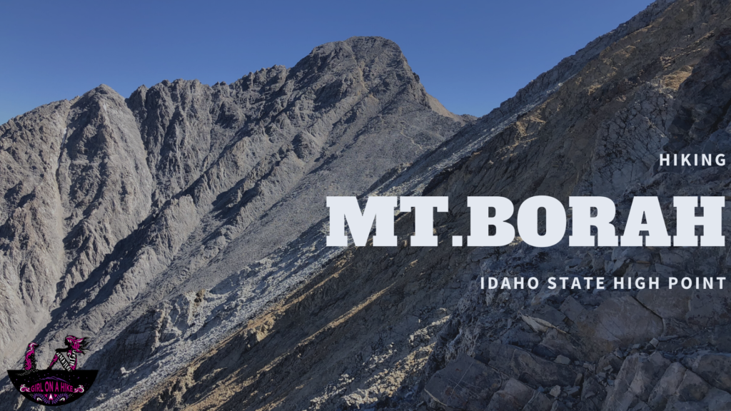
Hiking to Mt.Borah, Idaho State High Point

Save me on Pinterest!