About
Directions
From Page, AZ drive south on HWY 89 for 3 miles, then look for the brown Horseshoe Bend sign pointing Right (West). There is a huge parking lot.
Trail Info
Distance: 3/4 mile one way
Elevation gain: 100 ft
Time: 30 minutes – 2 hours, depending on how long you stay at the rim
Dog friendly? Dogs are allowed and must stay on a leash
Kid friendly? Yes, but be aware of the ledges
FAQs
Do I need a permit?
No
When is the best time to visit?
Anytime of the year will be pretty, but as for time of day, it depends on what you are looking for. In my opinion, late afternoon to sunset is the best. For a photo of each time of day, check out this page.
What should I bring?
One water bottle, light jacket for the evening, and of course, a camera
Is this a safe place for kids and dogs?
As long as you hold your child’s hand and keep your dog on a leash, they will be fine. Just be aware of sheer drop offs along the rim.
I’m afraid of heights – what are some recommendations to still be able to view Horseshoe Bend?
If you are afraid of heights, still walk out to the rim, but lay down on your stomach or sit a few feet away from the rim. You will still be able to see everything, but will feel a little more secure if you sit or lie down.
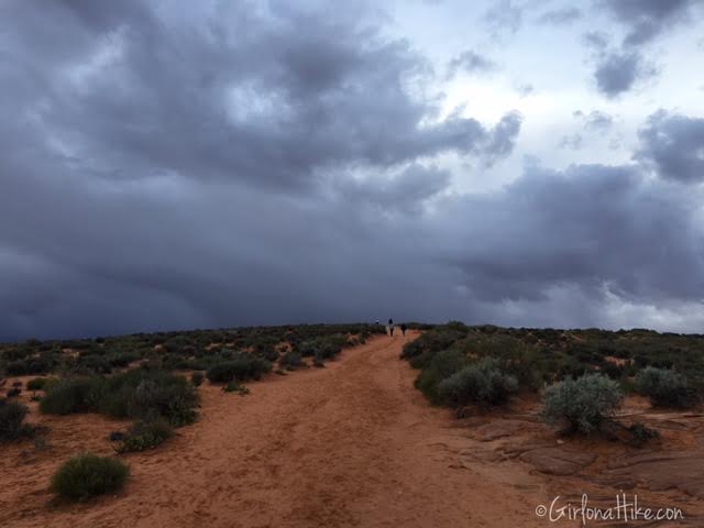
Walking up the trail, which is all soft sand. We could see the dark clouds moving in, so we did this as a fast hike at sunset.
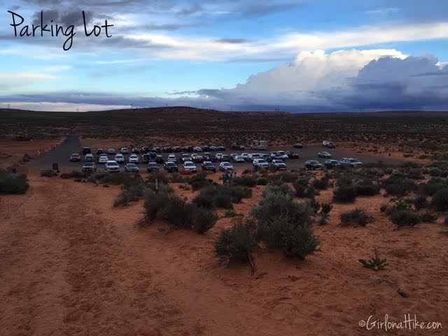
Don’t be fooled by all the awesome photos out there of people along the rim by themselves. The parking lot is huge, and there will be hundreds of people at one time along the rim to view Horseshoe Bend. In the past 6 years I have been here, this was the least amount of people I saw here.
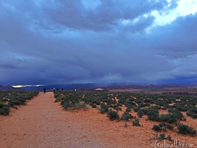
The trail flattens out at the top of the trail.
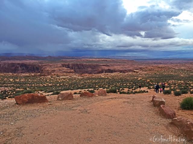
The trail then dips down again, and you can start to see people along the rim, and the curve in the rock.
Once at the rim, pick a spot and enjoy the view!
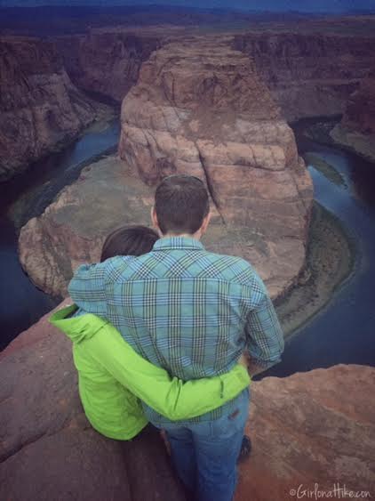
Enjoying time with my partner.
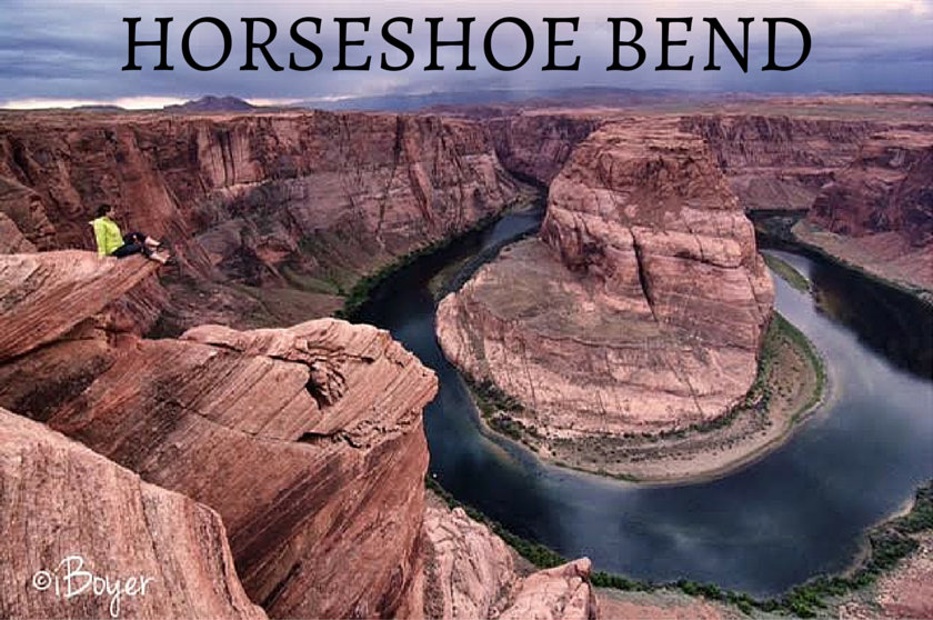
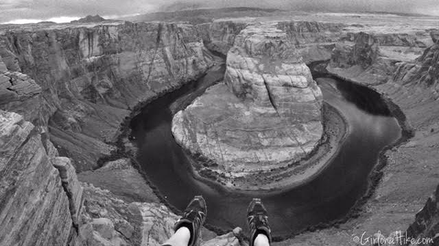
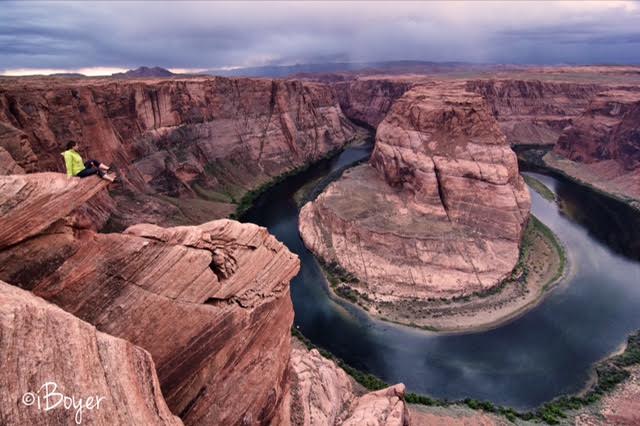
Just to the left of my head were campers at the bottom of the bend. The only way to get there is by rafting. Photo by @iBoyer.
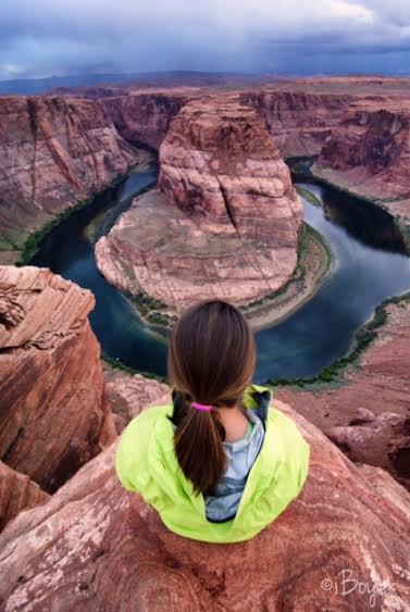
I can’t get enough of this view! Photo by @iBoyer.
Trail Map
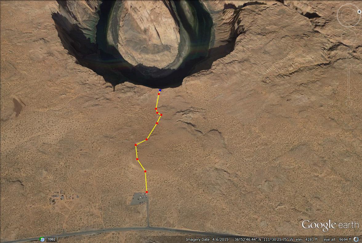
Trail map looking West.

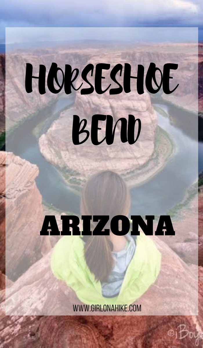
Save me on Pinterest!