


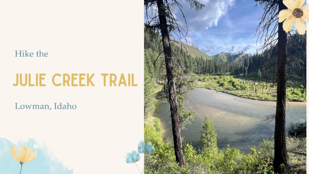
Hiking the Julie Creek Trail Near Lowman, Idaho is a stunning, gradual multiuse trail for hikers, bikers, and ATV enthusiasts.
About the Julie Creek Trail
Trail Conditions and Terrain
The Julie Creek Trail follows the scenic Deadwood River, which flows south from the Deadwood Reservoir. This gradual and easy-to-follow trail can be hiked as an out-and-back or combined with the nearby Deadwood Trail to create a roughly 25-mile loop. For this outing, I was training for an ultramarathon and needed a 14-mile round-trip run, so my goal was to reach the bridge located about 7 miles from the trailhead.
This moderately popular Idaho hiking trail offers expansive views of the Deadwood River canyon, although shade is limited for most of the route. For most of the hike, the trail stays high above the river before descending near the end, where it crosses a large slide area.
Water Availability on the Trail
One of the advantages of hiking the Julie Creek Trail in spring is the abundance of seasonal streams that flow into the Deadwood River, providing multiple opportunities to filter water along the way. I filtered water near the slide area at approximately mile 6.8 before continuing to the bridge.
Trail Running on Julie Creek Trail
The Julie Creek Trail is an excellent option for trail runners looking to log higher mileage. The gradual grade, long stretches of runnable terrain, and reliable water sources make it a great choice for marathon and ultramarathon training. Depending on your goals, you can complete an out-and-back run or connect with the Deadwood Trail to create a loop of approximately 25 miles.
Best Time to Hike Julie Creek Trail
The Julie Creek Trail is typically accessible from May through October, depending on snow conditions and when the seasonal gate opens. If the gate is still closed, you can begin hiking from the winter gate, which is what I did to complete my 7-mile one-way route.
Pigeon Flat Viewpoint
If you’re short on time, I highly recommend hiking at least the first mile to reach the impressive river bend known as Pigeon Flat. This scenic overlook provides beautiful views of the Deadwood River and makes for a worthwhile destination even if you don’t have time to complete the full hike.
Hiking with Dogs
The Julie Creek Trail is dog-friendly and offers plenty of opportunities for dogs to access water throughout the hike. Wildlife is common in the area, however, so it’s always a good idea to keep a leash handy, carry bear spray, and remain aware of your surroundings. Dogs will enjoy the gradual terrain and frequent creek crossings along the route.
Directions
From Lowman, Idaho, drive west on Highway 17 toward Banks for approximately 4 miles. Turn right onto Forest Road 579 (Deadwood Reservoir Road) and continue toward Deadwood Reservoir.
Cross the Deadwood River and continue north past Deadwood Campground. About 1 mile beyond the campground, turn right onto the signed road for the Julie Creek Trailhead. Follow this road for approximately 1 mile to reach the trailhead parking area.
If the seasonal gate is closed, park at the winter gate and begin hiking from there. This adds additional mileage to the route but provides access to the same trail.
The Julie Creek Trailhead sits on the west side of the Deadwood River and serves both the Julie Creek Trail (#020) and Nellie’s Basin Trail (#022). Trailhead facilities are limited, so bring plenty of water and be prepared for changing mountain conditions.
GPS Coordinates:
44.090511, -115.662694
Here is a driving map.
Trail Info
Distance: Flexible. Hike as far as you’d like. I hiked 7 miles one-way (14 miles round trip) to the bridge.
Elevation Gain: Approximately 800 feet (one way)
Time Required: Varies depending on turnaround point and pace
Dog Friendly: Yes, dogs are allowed off leash if under voice control
Kid Friendly: Yes, recommended for ages 10+
Fees/Permits: None
Hiking the Julie Creek Trail: What to Expect
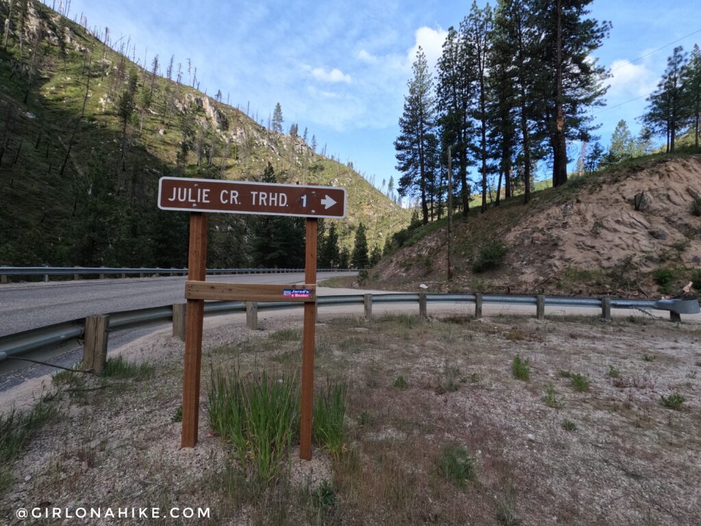
The Julie Creek Trailhead sign is right off the road and easy to see. There is a large parking lot here, as well as at the main TH. This is looking West on the Banks Lowman Road.
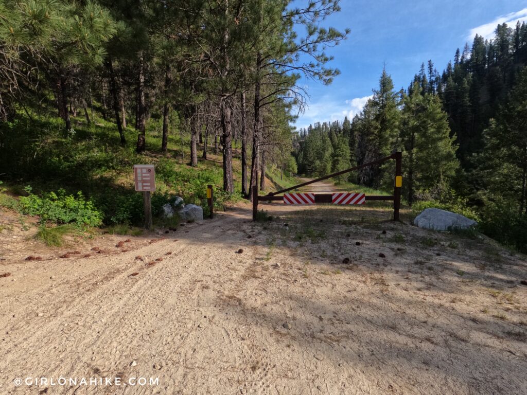
If you want to shave off 1 mile park at the actual TH, which has an even larger parking lot with a port-a-potty. The trail begins at this gate.
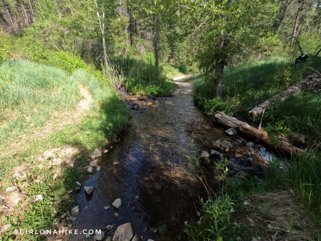
1.5 miles from the main road across a creek. This is a good place to filter water, if needed.
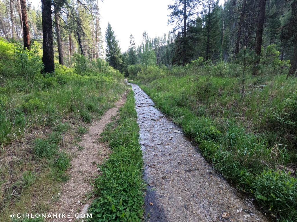
The trail itself is a creek during Spring run-off, so the higher left trail is often used.
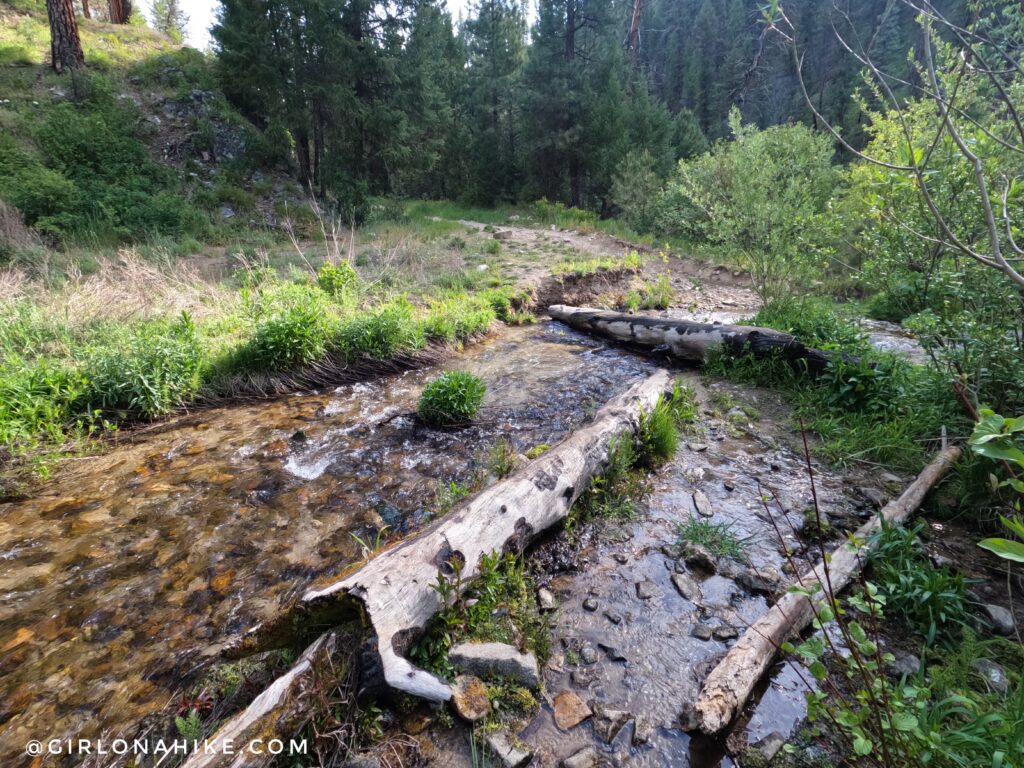
Another creek crossing.
Pigeon Flat Overlook
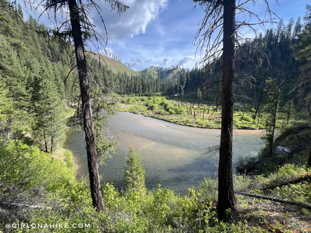
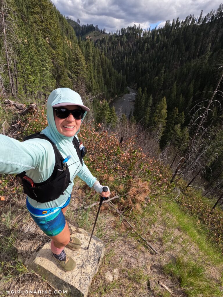
At 1 mile from the main Julie Creek Trailhead, you’ll reach an incredible viewpoint overlooking Pigeon Flat and the Deadwood River canyon. If you’re short on time, I highly recommend hiking at least this far, as it offers one of the best views along the Julie Creek Trail.

At 2.54 miles you will see the first of many “Caution” signs for a very narrow trail/ATV road.
Looking back across Pidgeon Flat, the view was incredible.
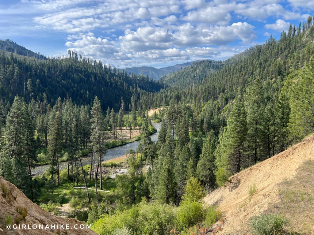
As the Julie Creek Trail continues along the canyon, nearly every bend reveals new views of the Deadwood River below. Between the open hillsides, rugged terrain, and distant mountain scenery, it was hard not to stop for photos every few minutes.
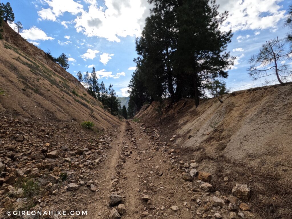
This was the rockiest section of the trail, though it was still relatively easy to navigate. For trail runners, most of the route consists of packed dirt with gradual grades, making it an excellent option for marathon and ultramarathon training.
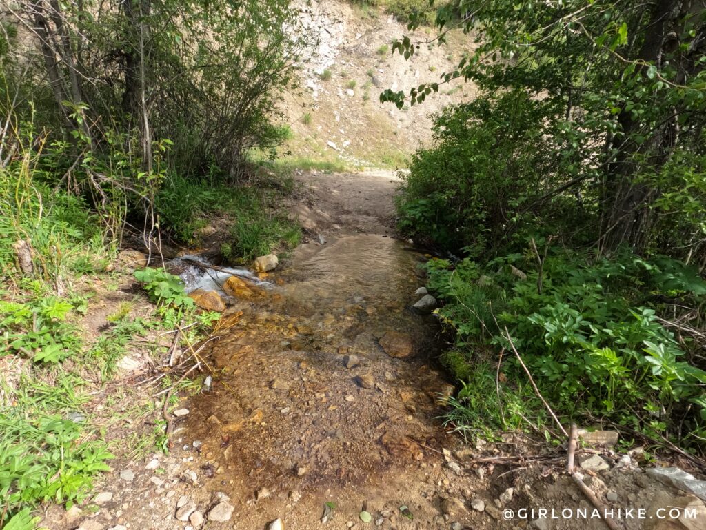
At approximately 4 miles, the Julie Creek Trail crosses another seasonal creek. This is an excellent location to filter water, cool off in the shade, or take a short break before continuing deeper into the Deadwood River drainage.
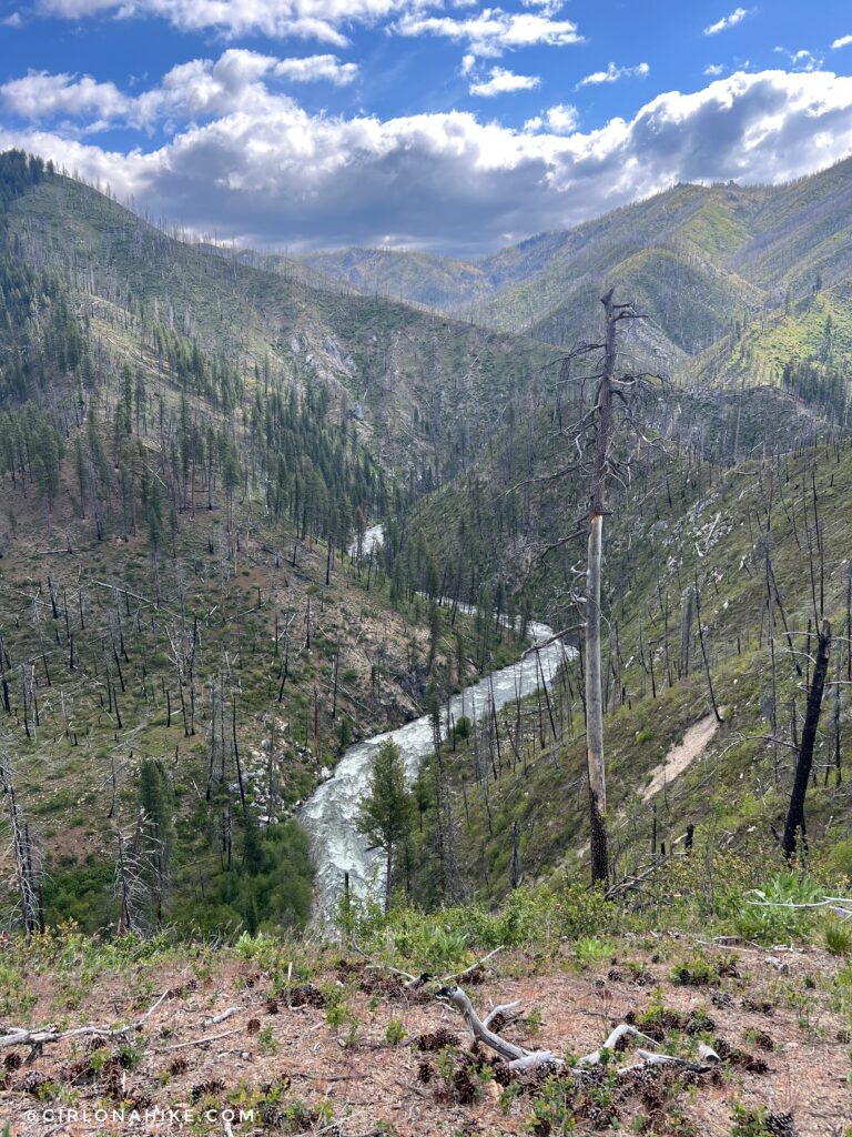
Evidence of past wildfire activity can be seen from this viewpoint, but it also provides sweeping views across the surrounding mountains and valleys. From here, the trail begins a gradual descent for the next 1.5 miles toward the Deadwood River.
Deadwood River Access
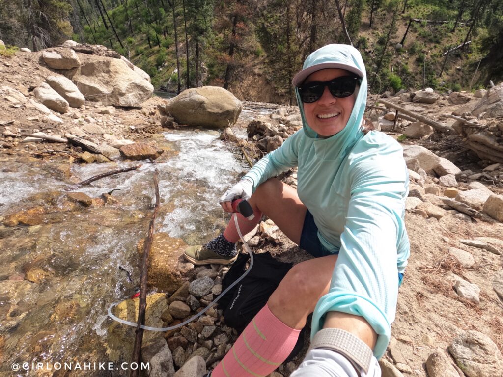
At approximately 6.8 miles, the Julie Creek Trail crosses a large historic landslide area. This is one of the few places where hikers can easily access the Deadwood River, making it an ideal spot to filter water, cool off, or enjoy a shaded break before reaching the bridge.
For long runs, I filter using the MSR HyperFlow, and I love it!
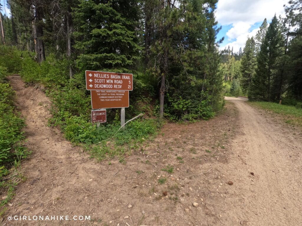
Just before reaching the bridge, you’ll encounter the only major junction along the Julie Creek Trail. The left fork leads toward Nellie’s Basin Trail, Scott Mountain Road, and Deadwood Reservoir. To continue toward the bridge, stay straight.
Bridge Turnaround Point
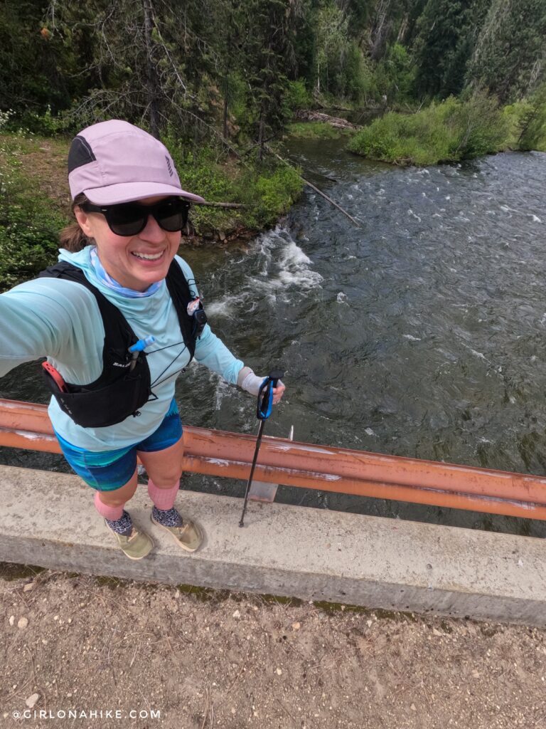
After 7 miles of hiking and trail running, I finally reached the bridge spanning the Deadwood River. This made the perfect turnaround point for my 14-mile training run and a great place to relax, refuel, and enjoy the scenery before heading back.
Trail Map
My track via Gaia GPS – the best tracking app! Get your app here for a discount.
Nearby Hike
Hike the Station Creek Trail near Garden Valley, Idaho


Save me on Pinterest!

![]()

